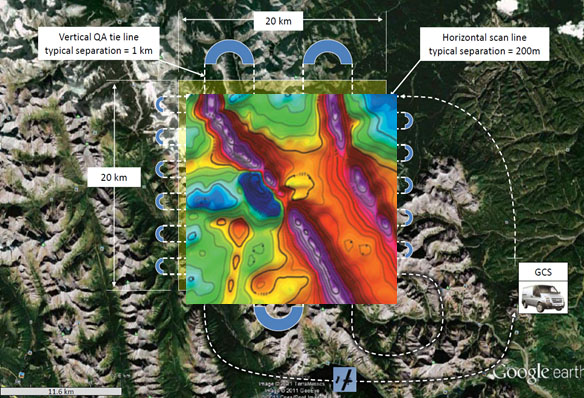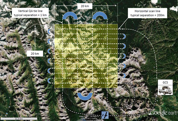
Traditionally, a single manned, or unmanned, aircraft would fly a raster scan to perform a survey, as shown above. The advantage of using a formation of UAVs, rather than a single UAV, to perform a geophysical survey is lower cost because staff salaries are the dominant cost, and the three staff members at the GCS can manage a formation of UAVs from one GCS. Additionally, the survey is also completed more quickly.