- Visible spectrum colour digital photographs and high resolution thermal camera images
- After the UAV has returned, the photographs are stitched together to form a large map
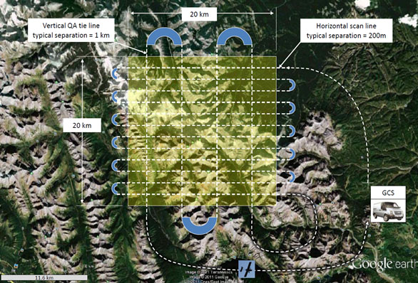
Traditionally, a single manned, or unmanned, aircraft would fly a raster scan to perform a survey, as shown above. The advantage of using a formation of UAVs, rather than a single UAV, to perform a geophysical survey is lower cost because staff salaries are the dominant cost, and the three staff members at the GCS can manage a formation of UAVs from one GCS. Additionally, the survey is also completed more quickly.
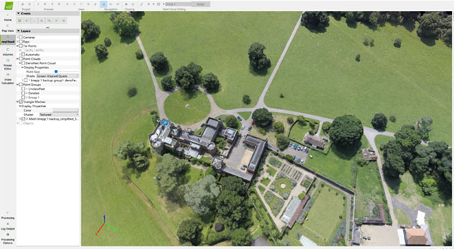
Pix4D software is used to generate 2D and 3D maps from the photographs taken from the UAV.
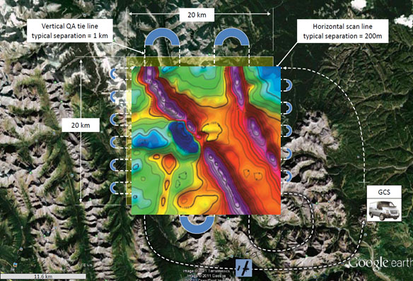
Magnetic intensity contour map of the Alloa Kinross region in Scotland.