A suggested way to detect oil leakage
Use a small Unmanned Aircraft (UA), on which is mounted a small thermal imagingcamera, to fly autonomously along the pipeline, just after sunset, to record the thermal images of the ground, from which one can deduce the thermal heat capacity of the ground, around the pipeline.
Just after sunset, there will be a drop in temperature, just as there will be an increase after sunrise, and one can interpret the thermal images, to estimate the heat capacity of the ground. If these images are taken once a day, one should be able to detect leakage from any of the 60,000 pipeline joints (according to the Sunday Times article), as a change in heat capacity of the ground, in the vicinity of the leaking joint.
In fact, one should have a time dependent view of the changes. This suggested approach rests on the heat capacity of the oil and the ground being different from that of the ground alone.
Features
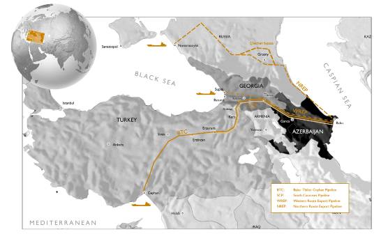
Route of the BTC pipeline through Azerbaijan, Georgia and Turkey
- 1,768 Km long
- 655,000 tons of steel in over 150,000 steel pipes from Sumitomo
- 8 pumping stations
- Capacity of 1 million barrels per day
- Operational in May 2005
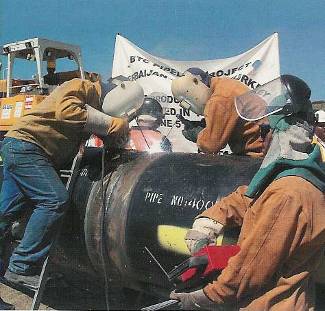
The first weld…
What's involved
The average speed of the first FAI Class F / F3A Model Plane to cross the Atlantic was 77.7 Kph, as it flew from Canada to Ireland. TAM5 flew an incredible 3,020 Km, relying on a GPS unit for guidance. In the TAM 5, a 10 cc four stroke model aircraft engine was used, as the propulsion source for the 5 Kg fully fuelled weight of the plane.
Since it would take a small plane flying 80 Kph roughly 22 hours to fly the length of the pipeline, it may be better to fly between pumping stations, including the end points of the pipeline.
With 8 pumping stations, one would estimate an average distance between pumping stations of 221 Km. A small plane, flying at 80 Kph, would take 2 hours 45 minutes to cover the average distance between pumping stations. This is a more realistic proposition but would require at least 8 small planes, to scan the entire pipeline, in under 3 hours.
Issues one would need to address are as follows:
- Use both thermal and visual imaging systems, on each UAV.
- Use GPS navigation, with an inertial guidance system, as a back up.
- Use satellite telemetry, with GSM mobile phone, as a telemetry back up.
- Use automated take-off and landing, so skilled air staff will not be required to operate the regular flights: all someone will need to do is to add fuel and start.
- Make sure the plane is designed not to cause damage, or, injury should it crash (for example, run out of fuel, or, electric power, or, whatever).
- Make sure international boundaries and regulations (including use of air space and permitted noise levels) are adhered to.
- Might need to use a low vibration Wankel engine, to propel the UAV, rather than a four stroke engine, for improved imaging quality.
- Use computer based image analysis, to help in the spotting of a spreading sub-surface oil leak from any part of the pipeline.
In the first instance, one would construct a 3D computer based thermal model of the buried pipeline and surrounding soil, complete with heat capacity and thermal conductivity data, for the materials in the vicinity and along the pipeline. One would also need to monitor the temperatures at various depths along the pipeline, to determine the heating effect of the sun’s rays during day time and the rate of cooling, as a function of depth and location along the pipeline, during the night time.
With a combination of the computer model and measurement information, one would relate the minimum sensitivity of a thermal imaging system to the size of the leak that could be detected. The measurement information would also be used to determine the best time to perform the thermal imaging, intuitively, just after sunset.